Watch How America’s Lands Changed From Forests to Fields

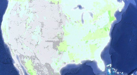
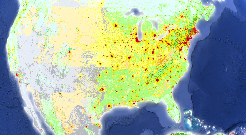
From 1700 to 2000, the evolution of American anthromes. Photo: Erle Ellis
In the maps above, Erle Ellis, a professor of geography at University of Maryland, Baltimore County, has mapped the “anthromes”—the concept is similar to a biome, but based on humanity’s effect on the landscape—of the United States. Cities are red, woodlands are green, wild land is gray, croplands are yellow, and rangelands are orange. While biomes are used to classify the world’s various ecosystems, as an acknowledgement of the human influence some researchers, including Ellis, have turned to thinking about anthropogenic biomes—”a matrix of human-altered croplands, pastures, towns and cities…’anthromes’ for short,” explains Ensia magazine.
The U.S. spans a huge range of biomes, from temperate humid to Mediterranean, with deserts hot and cold and a cap of boreal forest (both humid and semi-arid). But humans have amassed a huge amount of control over our environments. Here, we’ve used Ellis’ images to showcase how land use in the U.S. has evolved over the past 300 years. You can see woodlands turn to croplands, wild lands turned to expanding rangeland, and cities sprout where none existed.
More from Smithsonian.com:
How The Fukushima Exclusion Zone Shows Us What Comes After The Anthropocene
What is the Anthropocene and Are We in It?
Link:


