Tag Archives: colorado river

Will Congress leave the Colorado River high and dry?

Subscribe to The Beacon

Imagine this grim scenario: The drought that has plagued the Colorado River over the past two decades continues into 2021. The water level in Lake Mead drops precipitously, hitting the 1,075 feet mark — a critical threshold that triggers mandatory water restrictions — and then plunges further. The seven Western states that rely on the beleaguered river are forced to reduce the amount of water they draw, threatening water supplies for Phoenix, Las Vegas and other cities and forcing farmers to let thousands of acres lie fallow. Hydropower production at Hoover and Glen Canyon dams becomes impossible.

That may sound far-fetched, but it’s the picture representatives of the seven Colorado River basin states recently painted of what lies ahead if Congress didn’t authorize a drought plan the states put together for the river soon.

“The urgency is real because our system is stressed by warmer temperatures,” Colorado’s lead water official, James Eklund, told the House Natural Resources Committee last week. “When water resources are stressed in any river basin, our environments and people in poverty bear a disproportionate amount of the pain,” he said. “We really need you to, in order for us to control our own destiny, act now.”

It’s no exaggeration to say that the Colorado River is the lifeblood of the American West, a source of water for 40 million people and 5.5 million acres of farmland. But the river has been under enormous stress. Among the many problems: a long-running drought, ballooning demand for water as cities in the West grow, poor policies that incentivize water waste, bad underlying data that led water managers to believe the river held more water than it did, and, of course, warming temperatures.

After months of negotiations, the seven Colorado River basin states settled on a drought plan they can live with last month. Now, they’re asking Congress authorize the federal government to implement the plan. Senator Martha McSally and Congressman Raúl Grijalva, both from Arizona, introduced legislation on Tuesday to do just that.

Here’s a look at what’s at stake as well as other potential land mines that lie ahead.

So, how’d we get here?

To understand why the Colorado River is in the sorry state that it is today, you have to go back to 1922 when a compact was signed by the seven states — Arizona, California, Nevada, New Mexico, Colorado, Utah and Wyoming — that share the Colorado River’s water. At the time, the states believed that roughly 18 million acre-feet flowed through the Colorado. (One acre-feet is the amount of water needed to flood a one-acre field with a foot of water. It’s about 325,000 gallons.)

But that was based on surveys collected during an extremely wet period in the river’s history. More recent studies show that its river’s annual flow is about 15 million acre-feet. Since the states divvied up the water based on information gathered in an exceptionally wet year, states have rights to more water than is available in the river. It’s like promising 18 slices of pie when you only have 15.

This “structural deficit,” as it’s called, is a major underlying issue in managing the river. Add it to the fact that cities in the West have grown dramatically in the last few decades and that farmers dependent on the Colorado are growing thirsty crops like cotton and alfalfa in the desert, and you can see why there’s just not enough water to keep everybody happy.

What about climate change?

It’s making the situation worse. More than half of the decrease in water in the river is a result of warming temperatures, according to recent research. The snowpack in the Rockies that feeds the river has been dwindling, and rising temperatures mean more water evaporates from the river. The Bureau of Reclamation, the federal agency that manages water in the West, projects that as the planet continues to warm and demand for water increases, the imbalance between the water available and human need will grow to 3.2 million acre-feet by 2060. That’s more than all the water allocated to Arizona from the river at the moment.

So how does the drought plan help?

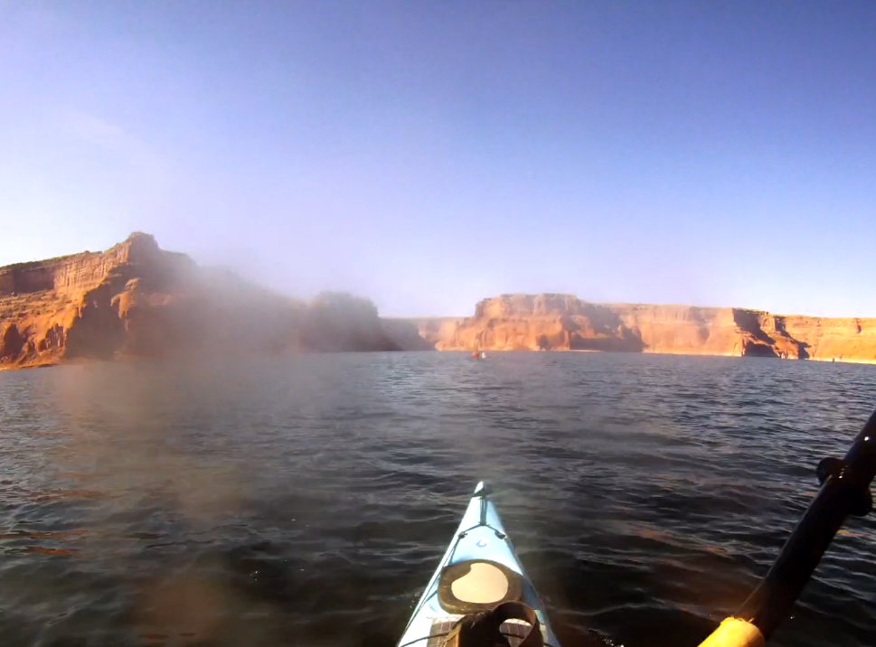
Lake Mead is a critical reservoir on the Colorado River that has the capacity to store the entire flow of the river for two years. If levels at Lake Mead sink to 1,075 feet, it will automatically trigger cuts to water use. Water managers have called this mandatory restriction “draconian” because it follows a set of laws that primarily cut off water users with newer water rights. There’ll be little room for compromise or trade offs. Lake Mead currently sits at 1,090 feet, and the Bureau of Reclamation has estimated that there is more than a 50 percent chance there will be a shortage in the lake in 2020.

The states are now trying to avoid that situation by voluntarily agreeing to use less water. California, Arizona and Nevada have agreed to decrease the amount they pull from the river by 400,000 to 600,000 acre-feet every year depending on how low water levels get at Lake Mead. An international treaty between the U.S. and Mexico also requires the U.S. to deliver 1.5 million acre-feet of water to Mexico. A separate agreement has been reached with Mexico to conserve water.

All this talk of compromise is at odds with the oft-repeated maxim in the water world that whiskey is for drinking and water is for fighting over. Researchers expect that as climate change strains water availability, conflict over shared water resources will increase.

But at the Congressional hearings last week, lawmakers and state water managers emphasized collaboration. “There was a point in time when the Colorado River was the most litigated river in the world,” said John Entsminger, general manager of the Southern Nevada Water Authority. “Since the 1990s, we’ve been a model on how you can come together as a region.”

That’s all fine and dandy. What could go wrong though?

Always free, always fresh.

Ask your climate scientist if Grist is right for you. See our privacy policy

Well, there’s one key player that’s not on board with the current plan. Imperial Irrigation District is a powerful interest in California politics. It’s one of the biggest irrigation districts in the country and the river’s largest single user. In January, the district upset the states’ drought plan when it demanded $400 million in state and federal funds for rehabilitation work in the Salton Sea — California’s biggest lake — in exchange for its commitment to cut water use. The Salton Sea has shrunk dramatically in recent years exposing a contaminated lake bed and threatening nearby communities with toxic dust.

Though the district had the support of powerful politicians, including Senator Dianne Feinstein, other water users in the state balked at the demand. In February, the Metropolitan Water District of Southern California, which supplies water to Los Angeles, stepped up and agreed to contribute IID’s share. That left IID with no role to play in the drought plan.

IID has issued strongly-worded statements claiming the Salton Sea issue is the “proving ground” for the drought plan and that by sidestepping the issue, water users on the Colorado are “just fooling themselves or have other agendas.” Representatives for the irrigation district were reportedly on Capitol Hill lobbying lawmakers last week.

What happens next?

The seven Colorado River states have set a deadline of April 22 for Congress to pass legislation signing off on their drought plan. What happens if they don’t? Mexico wouldn’t have to cut its water use in 2020 as promised.

In a press release, Patrick Tyrrell, Wyoming’s state engineer, said that the drought plan is an “indispensable bridge” until the states negotiate a longer-term solution. “With these plans, we have direction,” he said. “Without them, we face an uncertain future and increased risks.”

View this article: 

Will Congress leave the Colorado River high and dry?

Posted in Accent, alo, Anchor, FF, G & F, GE, LAI, LG, ONA, ProPublica, Radius, Salton, Uncategorized, Wiley | Tagged , , , , , , , , , , | Comments Off on Will Congress leave the Colorado River high and dry?

America’s fastest-growing urban area is stuck between a rock and a dry place

This story was originally published by CityLab and is reproduced here as part of the Climate Desk collaboration.

When Latter-day Saint migrants arrived in Utah in 1847, a verse in Isaiah served as consolation to them in the desiccated landscape: “The wilderness and the solitary place shall be glad for them; and the desert shall rejoice, and blossom as the rose.”

Lately, the desert has blossomed nowhere more than the St. George area, in the state’s southern reaches. The city is a picturesque outpost, with red-rock desert framing bright green lawns and golf courses, all built around the stark white Mormon temple in the center of town.

Brigham Young’s adherents came here to grow crops, primarily cotton — hence its reputation as Utah’s Dixie. Today, that ceaseless sunshine is luring so many tourists, retirees, and students that St. George has become the fastest-growing metropolitan area in the country. According to Census Bureau data released in March, the metro, home to 165,000 people, grew 4 percent between 2016 and 2017.

“Six million people visit the area every year. As people visit here, some of them decide to stay,” St. George Mayor Jon Pike said. The area remains a retirement community, “but we also have 33,000 students K through 12, and we have a fast-growing university [Dixie State University].” Healthcare is a booming industry, and, like many growing cities, St. George has a section of town earmarked for tech companies. Mixed-use developments are popping up downtown. The growth likely won’t slow any time soon: State demographers believe the area will surpass 500,000 residents by 2065.

As is the case with other growing desert burgs, St. George grapples with water-supply issues. But the challenge here is unique. Remarkably cheap rates mean that residents of an area with only eight inches of annual rainfall are using tremendous amounts of water. An average St. George resident uses more than twice as much water as the average citizen of Los Angeles.

Political leaders at the state and local level view this primarily as a supply issue. Their preferred solution is a gargantuan $1.4 billion pipeline that would connect the region with Lake Powell, a reservoir along the Colorado River. With the aid of pumping stations, the pipeline would shuttle water over 140 miles and 2,000 feet of elevation gain. The goal is to store 86,000 acre-feet a year in nearby reservoirs and aquifers — more than enough, officials say, to meet the demand of the growing population and decrease reliance on the dwindling Virgin River, currently Washington County’s primary water source.

“We certainly are committed to conservation, but we don’t think that gets you there alone, especially with the organic growth and the tremendous in-migration that’s occurring in the Southwest,” said Ronald Thompson, general manager of the Washington County Water Conservancy District, the wholesaler that supplies water to St. George and other cities in the county.

In 2006, the state legislature passed a bill to fund the Lake Powell project, but construction has been delayed since then by stop-and-go planning (at this point, pipeline approval is on hold due to uncertainty about which federal agency has jurisdiction over the project).

Multiple state and regional environmental groups say the pipeline is far too aggressive, and that basic conservation measures can meet the region’s water demand. Amelia Nuding, senior water analyst for Western Resource Advocates, believes regional leaders should focus on three strategies to achieve quick conservation success: better data collection, higher water rates, and building codes that require water-smart construction and landscaping. Not only would that meet St. George’s water needs, according to Nuding’s group, but it would avoid further depleting an already burdened Colorado River.

Utah typically uses less than its allotted share of Colorado River water, which is divvied up among Western states, but climate change and growing populations are taxing relations among the river’s interstate constituents. “Yes, [Utah residents] are legally entitled to that water from the Colorado River,” Nuding said. “But … I think that we should meet certain metrics of water stewardship before further depleting the Colorado River.”

Leaders have, for the most part, ignored environmentalists’ suggestions. Water-use data in Utah is scant; until recently, statewide water surveys took place only every five years. In 2010 — the latest state data available — the St. George region’s per-capita consumption was 325 gallons per day. More current numbers from the city suggest conservation; St. George proper uses 250 gallons per person per day. Nonetheless, it’s still consuming more water than other Southwest cities. Las Vegas takes about 220 gallons per person each day; Tucson, considered a regional leader, uses 120.

Water rates here don’t punish heavy use. A St. George household that goes through 16,000 gallons a month would see a $47 water bill; equivalent usage would cost a Tucson household $184. Washington County Water Conservancy District is in the process of raising rates 5 to 10 percent each year until baseline rates are tripled, but even then, they would be a bargain compared to some cities.

Utah’s water-delivery systems are largely gravity-fed, thus keeping costs down, and most homeowners have access to unmetered non-potable water for landscaping and irrigation. This, plus state oversight of water rates, keeps the rates low — and consumption high.

Any major reduction in consumption here will require a cultural shift. St. George is marketed as a desert oasis. Nine golf courses are located in the region, and it remains an agricultural stronghold. Local municipalities offer basic water-conservation rebates — St. George, for instance, helps cover the cost of replacing high-flow toilets — but nothing at the level of cities that, for instance, pay residents to replace sod with desert-appropriate landscaping.

Mayor Pike heralded developers who are voluntarily choosing water-smart appliances and landscaping, and cited the planned Desert Color community as an example. But that project’s water-wise cred has been questioned: Its centerpiece is an 18-acre artificial pond.

That said, St. George’s growth could inherently promote efficiencies. Apartment and townhouse construction is finally catching up with demand, which will keep some new residents from the sprawling single-family homes and yards that guzzle so much water. A good deal of new construction will take place on agricultural land where water is already allocated.

But per-person efficiency doesn’t mean less water use overall. Every St. George resident could cut her water use in half, but if the population more than doubles, the city is still using more water. Such is the conundrum of desert growth. “We’d be wise to diversify our sources,” Pike said. “If the Powell pipeline isn’t built, that would change things. … It would slow growth.”

Constructing the pipeline, oddly enough, might trigger cost increases that could curtail water use. While the state would cover the pipeline’s initial costs, locals are on the hook in the long run. In a letter to Utah’s governor, economists at state universities said that water rates would have to jump sixfold for the region to meet its repayment obligations. “Of course, increasing water rates this much would significantly decrease Washington County residents’ demand for water,” the economists wrote. “In our analysis, demand decreased so much that the [Lake Powell pipeline] water would go unused.”

If rates are going up anyway, conservation advocates think the pipeline talk is occurring too soon. “Why don’t they just try [raising rates] now, and see how much demand changes?” Nuding said. “From a water-management perspective, that makes all the sense in the world.”

In this blossoming desert city, leaders have a choice: Do they let the roses go brown, or pay exorbitantly to keep them?

Original source: 

America’s fastest-growing urban area is stuck between a rock and a dry place

Posted in alo, ALPHA, Anchor, Citizen, FF, GE, ONA, organic, solar, Uncategorized | Tagged , , , , , , , , , , | Comments Off on America’s fastest-growing urban area is stuck between a rock and a dry place

Lack of snowpack leaves the West hung out to dry

The lack of snow across the West this winter points to a parched summer ahead.

In California, Colorado, and across the Southwest, the snowfall has ranked among the lowest on record. The last four months have also been among the warmest throughout most of the region, according to a report out last week. Parts of eight states already are already under “extreme” drought conditions.

Snowy, chilly winters are critical when it comes to recharging the West’s mountain snowpack, the source of water for rivers and reservoirs during the increasingly long and hot summer days. Less snow in the mountains, in other words, means less water for everybody living below.

“I don’t think it’s hyperbolic to say that this winter is the stuff of nightmares for water managers in the Colorado River watershed,” says Luke Runyon, a Colorado-based public radio reporter focusing on western water. Some 40 million people in seven states depend on water from the Colorado River, and at this point, spring storms across the river’s wide drainage area would need to produce snow at more than 300 percent of the typical rate just to get back to normal for the season.

In the river’s main storage spot, Lake Mead just south of Las Vegas, Nevada, water levels are on track to fall so low that they would trigger the first-ever official shortfall late next year, according to new data from the U.S. Bureau of Reclamation. Water rationing would be the next step.

Warmer, drier winters like this one are exactly what you’d expect with climate change. A new study published earlier this month showed that over the past 100 years, more than 90 percent of snow monitoring sites throughout the West have seen a decline in snowpack. In total, that’s a loss of summertime water storage equivalent to Lake Mead.

“It is a bigger decline than we had expected,” said Philip Mote, a climate scientist at Oregon State University and lead author on the study, in a statement. “In many lower-elevation sites, what used to fall as snow is now rain.”

The evidence of dwindling snowpack is nearly everywhere you look. According to the latest information from the National Oceanic and Atmospheric Administration, the period between Nov. 1 and Feb. 28 was at or near the warmest and driest on record for nearly every corner of the Southwest. In Arizona, the Navajo Nation has declared a drought emergency, and farmers across the West are preparing for a dry summer, contemplating killing livestock for fear they won’t be able to feed them later this year. Last week, a 23,000-acre wildfire popped up near the Colorado-New Mexico border, a striking example of just how dry things are right now.

In California, statewide snowpack on March 1 rivaled the lowest ever measured, just 19 percent of normal. A series of big storms have since nudged that value to about 37 percent of normal — a major win in a state where every drop counts. One problem, though: New data from the California’s Water Resources Control Board show that people are using more water after last year’s relatively good rains, as usage rates are back near where they were before the state’s five-year drought. It seems that many Californians have already forgotten what they learned about how to save water.

Faith Kearns, a water scientist at the California Institute for Water Resources, says the state is already planning on varying levels of shortfalls this summer. “It’s going to be another dry year,” she says. “Our reservoirs are in decent shape from last year’s storms, but we need to continue conserving.”

It’s clear that the West’s steady and transformative slide into a drier future has already begun. This is just the start.

Credit:  

Lack of snowpack leaves the West hung out to dry

Posted in alo, Anchor, Eureka, FF, G & F, GE, LG, ONA, solar, Uncategorized | Tagged , , , , , , , , , , | Comments Off on Lack of snowpack leaves the West hung out to dry

1.5 million Puerto Ricans don’t have safe drinking water.

The federal lawsuit, filed this week by the environmental group Deep Green Resistance, seeks to protect the Colorado River — a water source for Los Angeles, Phoenix, Denver, and Las Vegas, among other desert-strewn metro areas.

The New York Times reports that the state of Colorado has been sued for failing to protect the river and its “right to flourish” by allowing pollution and general degradation. The plaintiff’s attorney — the plaintiff being the Colorado River — is Jason Flores-Williams, who told the New York Times that there is a fundamental disparity in rights of “entities that are using nature and nature itself.”

Those entities are primarily corporations, which have been granted human rights in major Supreme Court decisions over the past year. In the Citizens United and Hobby Lobby decisions, for example, the Supreme Court found that corporations should be afforded the human right to donate without limit to political campaigns and to refuse to comply with federal law on basis of religious freedom.

The main challenge for the river case is that a corporation is, by definition, a group of people — but hey, it’s worth a shot! Here’s a short video we made on why protecting waterways like the Colorado River is important, even for city-dwellers:

Visit source – 

1.5 million Puerto Ricans don’t have safe drinking water.

Posted in alo, Anchor, Cascade, Citizen, FF, GE, Jason, LAI, LG, ONA, Radius, Uncategorized | Tagged , , , , , , , , , | Comments Off on 1.5 million Puerto Ricans don’t have safe drinking water.

Your Winter Vegetables: Brought to You by California’s Very Last Drops of Water

Mother Jones

<!DOCTYPE html PUBLIC “-//W3C//DTD HTML 4.0 Transitional//EN” “http://www.w3.org/TR/REC-html40/loose.dtd”>

California’s drought-plagued Central Valley hogs the headlines, but two-thirds of your winter vegetables come from a different part of the state. Occupying a land mass a mere eighth the size of metro Los Angeles, the Imperial Valley churns out about two-thirds of the vegetables eaten by Americans during the winter. Major crops include broccoli, cabbage, carrots, cauliflower, and, most famously, lettuce and salad mix.

And those aren’t even the region’s biggest moneymakers. Nestled in the state’s southeastern corner, the Imperial Valley also produces massive amounts of alfalfa, a cattle feed, and its teeming feedlots finish some 350,000 beef cows per year.

In terms of native aquatic resources, the Imperial makes the Central Valley look like Waterworld. At least the Central Valley is bound by mountain ranges to the east that, in good years (not the last several), deliver abundant snowmelt for irrigation. The Imperial sits in the middle of the blazing-hot Sonoran Dessert, with no water-trapping mountains anywhere nearby. It receives a whopping 3 inches of precipitation per year on average; even the more arid half of the Central Valley gets 15 inches.

The sole source of water in the Imperial Valley is the Colorado River, which originates hundreds of miles northeast, in the snowy peaks of the Rocky Mountains. As it winds down from its source in the snow-capped peaks of northern Colorado down to Mexico, it delivers a total of 16.5 million acre-feet of water to the farmers and 40 million consumers in seven US states and northern Mexico who rely on it. (An acre-foot is the amount it takes to flood an acre of land with 12 inches of water—about 326,000 gallons.)

Of that total, the Imperial Valley’s farms gets 3.1 million acre-feet annually—more than half of California’s total allotment and more than any other state draws from the river besides Colorado. It’s an amount of water equivalent to more than four times what Los Angeles uses in a year, according to figures from the Pacific Institute.

The Colorado Rivers waters are so in demand that they rarely reach their endpoint in Mexico’s Sea of Cortez. Map: Shannon/Wikimedia Commons

Because it owns senior water rights based on a 1931 pact, the Imperial gets its allotments during low-flow years even when other regions see reductions. Currently, the Rocky Mountain snowpack that feeds the Colorado stands at about 44 percent of its average for this time of year, triggering fears of an impending shortfall—but not for the Imperial. “Nevada, southern Arizona and Mexico will be cut back before the Imperial district loses a drop,” The Los Angeles Times recently reported. Whereas Central Valley farmers, reliant on vanishing snowmelt from the Sierras, have seen their irrigation allotments curtailed the last two years, growers in the Imperial Valley haven’t lost any water (though the Imperial Valley District did agree to sell as much as 0.2 million acre-feet of water by 2021, of its 3.1 million acre-foot allotment, to fast-growing San Diego in a 2003 deal).

Already, decades of intensive desert farming have had severe ecological effects, epitomized by that beleaguered inland body of water known as the Salton Sea, which sits uneasily at the Imperial’s northern edge. Before the big irrigation projects that made the valley bloom, what’s now the Salton periodically captured flood waters from the then-mighty Colorado River. Now it’s fed solely from Imperial Valley farm runoff, and as Dana Goodyear shows in a superb recent New Yorker piece, it’s slowly decaying into a toxic mess—one that could “emit as much as a hundred tons of fine, caustic dust a day, leading to respiratory illness in the healthy and representing an acute hazard for people with compromised immune systems.”

Meanwhile, the Colorado’s flow has proven inadequate to supply the broader region’s needs. In a paper last year (my account of it here), University of California-Irvine and NASA researchers found that farmers, landowners, and municipalities are supplementing their river allocations by drawing water from underground aquifers at a much faster rate than had been known. Between December 2004 and November 2013, the Colorado Basin lost almost 53 million acre-feet of underground water, an enormous fossil resource siphoned away in less than a decade.

A desert in bloom: the Imperial Valley as seen from space, from a photo taken by NASA astronauts in 2002. Photo: NASA

Consider also that the Southwest’s population is on pace to expand by a third by 2030—and that the river’s annual average flow is expected to decrease by anywhere from 5 percent to 18 percent by 2050, compared to 20th century averages, according to the National Climate Assessment, throttled by rising temperatures and declining precipitation.

Thus the Imperial’s 2.6 million acre-foot allotment of water is looking increasingly vulnerable to challenge. Just as we probably need to get used to sourcing more of our summer fruits and vegetables from places beyond California’s Central and Salinas valleys, the Colorado River situation makes me wonder if we shouldn’t rethink those bountiful supermarket produce aisles in February, as well.

Read this article:  

Your Winter Vegetables: Brought to You by California’s Very Last Drops of Water

Posted in Anchor, FF, GE, LG, ONA, oven, PUR, Radius, Salton, Uncategorized, Wiley | Tagged , , , , , , , | Comments Off on Your Winter Vegetables: Brought to You by California’s Very Last Drops of Water

America’s largest reservoir is hitting new record lows every day

dude, where’s my water?

America’s largest reservoir is hitting new record lows every day

rjcox

The drought that’s afflicting much of the American West has hoovered out a record-breaking amount of water from the reservoir that’s held in place by the Hoover Dam.

Water levels in Lake Mead, the nation’s largest reservoir, have fallen to a point not seen since the reservoir was created during the 1930s to store water from the Colorado River. The Las Vegas Review-Journal reports that the surface of the reservoir dipped below 1,082 feet above sea level last week:

The past 15 years have been especially hard on the nation’s largest man-made reservoir. Lake Mead has seen its surface drop by more than 130 feet amid stubborn drought in the mountains that feed the Colorado River. The unusually dry conditions have exacerbated a fundamental math problem for the river, which now sustains 30 million people and several billion dollars worth of farm production across the West but has been over-appropriated since before Hoover Dam was built.

Andy Ameigeiras and two of his friends spent Wednesday night and Thursday morning hooking carp, catfish and stripers from the rocky shore of Echo Bay. He said the water had “easily” dropped three to five feet since the last time they fished there, just four weeks ago.

“I walked out there and I wasn’t sure I was in the right spot,” the Las Vegas man said. “It’s definitely startling to see how far it’s dropping.”

The latest low water mark comes less than four years after the previous record of 1,081.85 was set on Nov. 27, 2010.

Experts expect the water level to continue to fall during the coming weeks. Because the ways we’re using water in the American West during a widespread drought are simply unsustainable.


Source
Lake Mead sinks to a record low, Las Vegas Review-Journal

John Upton is a science fan and green news boffin who tweets, posts articles to Facebook, and blogs about ecology. He welcomes reader questions, tips, and incoherent rants: johnupton@gmail.com.

Find this article interesting? Donate now to support our work.Read more: Uncategorized

Originally posted here:

America’s largest reservoir is hitting new record lows every day

Posted in ALPHA, Anchor, FF, GE, LG, ONA, solar, solar panels, Uncategorized | Tagged , , , , , , , , , , | Comments Off on America’s largest reservoir is hitting new record lows every day

The Texas Tribune: Experts Urge Focus on Aquifers in Push for Water From Mexico

As Texas lawmakers say farmers in the Rio Grande Valley are hurting, experts caution that greater attention should be paid to water deep below the surface. Read the article: The Texas Tribune: Experts Urge Focus on Aquifers in Push for Water From Mexico Related Articles Dot Earth Blog: Urban Trees as Triggers, From Istanbul to Oregon The Texas Tribune: Abandoned Oil Wells Raise Fears of Pollution Dot Earth Blog: The End Comes for a Troubled California Nuclear Plant

See the original post:

The Texas Tribune: Experts Urge Focus on Aquifers in Push for Water From Mexico

Posted in eco-friendly, FF, G & F, GE, Monterey, ONA, solar, solar power, Uncategorized | Tagged , , , , , , , , | Comments Off on The Texas Tribune: Experts Urge Focus on Aquifers in Push for Water From Mexico

From Wyoming to Mexico, A Beautiful Time-Lapse Trip Down the Colorado River

Drawing rain runoff and snow melt from the slopes of the Rocky Mountains, the Colorado River is a dominant source of water for the American southwest, providing fresh water for drinking and farming and hydroelectric power to millions.

In 2011, Will Stauffer-Norris and Zak Podmore spent nearly four months kayaking and portaging and hiking the length of the Colorado River, from the Green River in Wyoming, which feeds into the Colorado, to the Sea of Cortez in Mexico. That 113 day journey was crushed into one beautiful three-and-a-half minute time lapse, showcasing the varied landscapes of the southwest, from the Grand Canyon to Lake Mead, the reservoir that feeds the Hoover Dam, to a narrow series of irrigation channels.

The pair used their journey to try to draw attention to the modern state of the Colorado River, which Smithsonian‘s Sarah Zielinski detailed in 2010:

The damming and diverting of the Colorado, the nation’s seventh-longest river, may be seen by some as a triumph of engineering and by others as a crime against nature, but there are ominous new twists. The river has been running especially low for the past decade, as drought has gripped the Southwest. It still tumbles through the Grand Canyon, much to the delight of rafters and other visitors. And boaters still roar across Nevada and Arizona’s Lake Mead, 110 miles long and formed by the Hoover Dam. But at the lake’s edge they can see lines in the rock walls, distinct as bathtub rings, showing the water level far lower than it once was—some 130 feet lower, as it happens, since 2000. Water resource officials say some of the reservoirs fed by the river will never be full again.

Indeed, in the video, you can see the powerful river’s flows dwindle as water is siphoned off for irrigation or power production as it makes its way downstream.

More from Smithsonian.com:

The Colorado River Runs Dry

Original post: 

From Wyoming to Mexico, A Beautiful Time-Lapse Trip Down the Colorado River

Posted in GE, LG, Uncategorized | Tagged , , , , , , , | Comments Off on From Wyoming to Mexico, A Beautiful Time-Lapse Trip Down the Colorado River